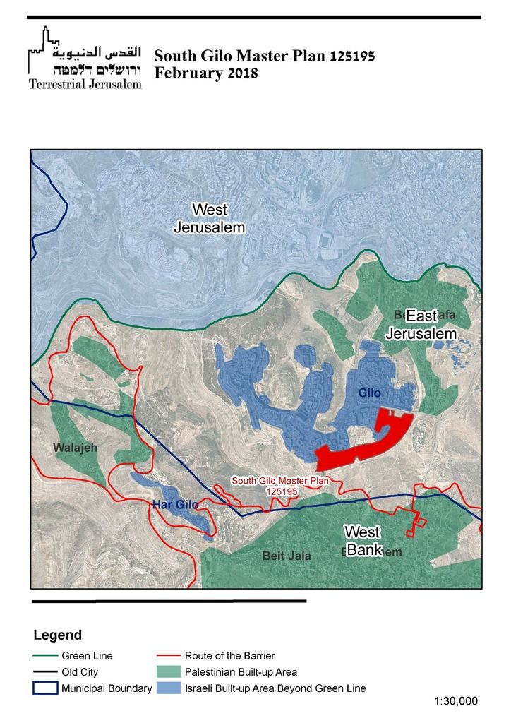
On February 21, the Jerusalem Municipality’s planning committee will consider Town Planning Scheme 125195, aka the Southeastern Gilo Master Plan (see the agenda of the committee in Hebrew here). According to the plan, 2,992 units could be built in a new neighborhood on the southeastern slopes between Gilo and Bethlehem, to the west of the Route 60 tunnel road (see map here). While there have been rumblings about this scheme in the past, the February 21st meeting formally launches the statutory planning process.This is what we reported in July 2017:
“A plan likely to be included in TP 125195 is Ahuzat Nof Gilo, which is in an embryonic stage, having not been approved or advanced in any significant way. The Ahuzat Nof Gilo plan provides for the construction of 2500 new units, located beyond the expropriation land Gilo, in the direction of Bethlehem and the Bethlehem checkpoint, on mainly private land (including Palestinian private land acquired by Israeli developers and “church” lands).“
With the initiation of this process, the details of the plan are no longer a matter of conjecture.
In 1995, Israel made a commitment to the U.S. government that no additional land in East Jerusalem would be expropriated for the purposes of building or expanding settlement neighborhoods. That commitment has guided the boundaries of Israeli settlement expansion in East Jerusalem in the ensuing years. While the scope of the expropriations under this scheme will be limited, this significantly contravenes the spirit of that undertaking, significantly expanding the built-up footprint of the Gilo settlement.
Even though the planning process of this new neighborhood in Gilo is likely to be complex, the filing of the plan is a significant step that confirms a major shift in Israeli settlement policies in East Jerusalem, with far-reaching implications.